 |
| RACHEL'S TOMB. |
|
[Table of Contents] [Previous] [Next] |
J. W. McGarvey Lands of the Bible (1881) |
C H A P T E R I I.
PLACES WITH JERUSALEM AS A CENTRE.
§ I.
ON THE ROAD TO BETHLEHEM.
THE road from Jerusalem to Bethlehem, distant six miles, follows the central ridge or water-shed of the hill country, and is the line of communication between Jerusalem and all of the southern part of the land of Israel. Starting from the Joppa gate, it descends southward into and across the Valley of Gihon, crossing on the bridge whose piers and arches support the aqueduct from Solomon's Pools,1 and then gradually ascending until it reaches the top of the ridge which extends westward from the southern side of the Valley of Hinnom. After reaching this height it descends by a gradual slope into a plain whose limit on the west is the broken country descending toward the Philis'tine Plain, and on the east a ridge which runs southward from the Valley of Hinnom, with a gradually diminishing height. The plain has a gentle slope toward the west, and it is called the Plain of Rephaim, or Valley of the Giants. It is here that David twice defeated the Philistines soon after he had taken possession of Jerusalem. They invaded his territory at the crisis in which he had just succeeded in suppressing the rebellion of Ishbosheth, and was in the act of fortifying his new capital, but were signally defeated in two battles fought in quick succession.2 The plain is also mentioned in Joshua xv. 8, where it is said that the boundary-line between Judah and Benjamin passed along the ridge which constitutes its northern border. As you descend from the ridge into this plain you see to your right, about half a mile distant, a row of neat new dwelling-houses of white limestone, occupied by Europeans. They are about a mile from the city.
About midway the plain, which is more than two miles long, you pass a well on the side of the road, which is called the Well of the Magi, from the tradition that the magi, or wise men, of Matt. ii. 1-12, [214] drank of it as they passed by. However idle this tradition may be, it reminds the traveler that he is on the very road which those mysterious strangers traveled as they were led by the star to Bethlehem. Two well-built villages, not named in the Scriptures, are seen some two or three miles to the right of the road, and two or three ruins of ancient towers dot the plain, but otherwise it is uninhabited, being an open, treeless field for the cultivation of grain. Traces of an ancient pavement are seen on the road at intervals, showing that it was once a paved highway, though now it consists merely of two or three smoothly-beaten bridle-paths running parallel to one another. It is the most frequented road coming into Jerusalem, with the exception of that from Joppa. Camels and asses loaded with fuel, lime, and other articles of traffic, men and women on foot, on asses, and on camels meet you at short intervals, and pass you with a glance of indifference.
As you reach the farther end of the plain, which narrows to a point and ascends a ridge of moderate height, you pass on your right the country residence of the Greek Patriarch, a substantial building surrounded by grounds pleasingly set in trees and inclosed by a stone fence. In front of it, on the opposite side of the road, is another well, affording excellent water, and supplied with stone watering-troughs for the accommodation of passing animals. The well is on the premises of a Greek convent, which stands a little farther up the road on the left, called Mar Elyas (Saint Elias). The original building of this convent was erected at an early but unknown date, and it is now occupied by a few Greek monks. The only hogs which the author saw in all his travels in Western Asia were three or four of a long-nosed breed in the yard of this convent.
In passing the convent you leave the Plain of Rephaim behind you, and the high ridge on its eastern border is also left behind, for here a deep valley from the direction of the Dead Sea heads close to the left-hand side of the road. You also, at this point, obtain your first view of Bethlehem,--a disappointing view, because of the dull, leaden color of its ancient stone houses. You are now half way between Jerusalem and Bethlehem. After riding half a mile or more farther you see at a distance on your right the large and well-built village of Bêt Jâ'la, containing about 3000 inhabitants. Its people are mostly Greek Christians, but it contains a Latin seminary, and also a Protestant missionary school. It is supposed to be the ancient Giloh, the home of Ahithophel the Gilonite, David's great counselor.3 It is mentioned in [215] Joshua xv. 51, among the towns in the territory of Judah. Here a road turns off to the right, passing Bêt Jâ'la, and running direct to Solomon's Pools and Hebron without passing through Bethlehem.
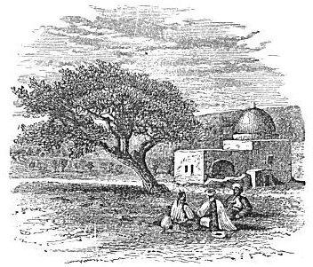
In the forks of the road stands a Mohammedan wely, marking the spot which has been regarded from the fourth century as the site of Rachel's Tomb.4 The present structure is modern, and is a small stone building surmounted by a plastered and whitewashed dome, with a room on the eastern side open to the north, designed for a sheltered place of prayer. Travelers have usually spoken of this as certainly the
|
| RACHEL'S TOMB. |
spot where Rachel was buried; but while its proximity to Bethlehem is well suited to the statement that when Rachel died "there was but a little way to come to Ephrath, which is Bethlehem,"5 the supposition that this is the true site is in palpable conflict with a statement found in 1 Samuel x. 2, where Samuel says to Saul, "When thou art departed from me today, then thou shalt find two men by Rachel's tomb in the border of Benjamin." This shows that Rachel's tomb, as known, and doubtless correctly known, in Samuel's time was in the border of Benjamin, and this, as we have just seen above, passed along the northern border of the Plain of Rephaim, about three miles farther north, and a little more than five miles from Bethlehem. This distance could be properly called "a little way to come to Bethlehem" [216]
 |
| BETHLEHEM FROM THE NORTHEAST. |
| Page 217. |
inasmuch as the comparison was with the distance to Bethel whence Jacob started, which is 18 miles from Bethlehem. The original tomb had stood about seven hundred years when Samuel mentioned it, and it was probably destroyed after this, and the new structure erected in the wrong place. In the seventh century a pyramid stood in place of the present wely.
§ II.
BETHLEHEM AND ITS VICINITY.
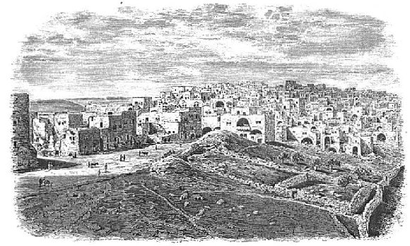
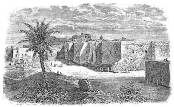
After passing Rachel's Tomb we soon enter the northern suburb of Bethlehem. Just as the road is about to become a street by passing between rows of houses you turn to the left a short distance, on a short ridge jutting out to the east, to examine the so-called David's Well,--the well from which a drink of water was brought to David by three of his heroes, who fought their way through the Philis'tine lines and back in order to bring it.6 The well is a very large rock-hewn cistern, 40 or 50 feet square, with six openings into it from the surface. The foundations of a ruined building which once covered all but one of the openings are distinctly traceable. At present it contains but little water, and the amount of surface which could have drained into it must always have been small, as it occupies the top of the ridge, with very little level surface about it. From this point there is a very good view of Bethlehem,--the view given in the cut on the opposite page. The old city lies on a ridge over against the one on which you stand, and parallel to it, the town stretching along its summit from east to west, while a deep valley, whose bottom and terraced sides are well cultivated, lies between. The eastern extremity of the town and of the ridge is occupied by the buildings of the Convent and Church of the Nativity, only a small part of which is seen in the cut, while the western end, which is higher, is occupied by some new schools and convents. With the exception of the new buildings just mentioned, the town has a dull leaden appearance, the result of the long exposure of its stone walls to the action of the atmosphere. But there is a new Bethlehem, as there is a new Jerusalem. When you return from David's Well to the road you enter a street which passes for two or three hundred yards between rows of newly-constructed houses, and some yet in course of construction, whose walls of yellowish-white limestone present a most pleasing contrast to the leaden hue [217] of the older town. This and the old town lie at a right angle to each other. On entering the old town you turn square to the left, ride through the principal bazaar, which has a somewhat lively business aspect, and pass on to the Church of the Nativity, at the eastern end of the town, its principal relic of antiquity. This is an irregular, antique, and extensive mass of buildings, with much the appearance of a fortification. It is said to include and cover the very spot in which Jesus was born and cradled in a manger; and if the evidence of the fact were conclusive, it would certainly be, as it is held to be by Latins, Greeks, and Armenians, the most interesting of sacred localities next to the holy sepulchre itself. The author was never able to obtain from the descriptions of travelers an intelligent conception of these buildings, and he will not attempt to convey one to others. Suffice it to say, that here are an Armenian, a Greek, and a Latin monastery and two churches all massed together in one confused pile. The cut on the opposite page very correctly represents its front as you approach it from the town. The principal entrance is in the angle of the building. The oldest part of the structure, the so-called Church of St. Mary, is said to have been erected by Constantine in the year 330, over the Cave or Grotto of the Nativity. Under the floor of the eastern end of this church is a flight of stone steps by which we descend into this artificial cavern. It is 13½ yards long by 4 in width, with a ceiling 10 feet high. It is kept continually lighted by a large number of silver lamps, belonging, some to the Greeks, some to the Latins, and some to the Armenians, all of whom have a claim on the place. In a semicircular recess at one side, where a silver star is let into the pavement, is shown the very spot where Jesus was born, and on the opposite side is the manger in which he was cradled. This manger is made of marble. Near by is pointed out the spot where the wise men kneeled to worship the child, and here hangs a picture of the scene. The cave winds about in a labyrinthine manner, and at other points in it are shown a hole in the rock from which water miraculously sprang up to supply the holy family, the spot at which Joseph was told to flee into Egypt, another at which some of the infants of Bethlehem were slain, the chapel and the tomb of Jerome,7 and the tomb of his friend and pupil, Eusebius.
The only historical ground for these traditions is the statement of Justin Martyr, in the second century, that Jesus was said to have been born in a cavern near Bethlehem. But the Scriptures represent him as [218]
 |
| CONVENT AND CHURCH OF THE NATIVITY, BETHLEHEM. |
| Page 218. |
being born in Bethlehem, not near it. Luke says that Mary "brought forth her first-born son and wrapped him in swaddling-clothes and laid him in a manger, because there was no room for them in the inn."8 From this it appears that Joseph sought accommodation in the inn, and could not obtain it because the house was crowded, doubtless by persons who had come up, like himself, to the enrollment. If the construction of the inn was similar to that of the khân, which is its modern representative in Asiatic cities, the first floor of the building was occupied by the animals of the inmates and visitors, the lodging-rooms of the latter being in the second story. The almost certain inference is that Joseph took temporary shelter in one of the stalls until room could be found for him above. That the stall should have been a cave dug down under the solid rock is in the highest degree improbable. Some caverns, both natural and artificial, whose openings are in the sides of hills, are now used for sheltering stock, and perhaps they were anciently, but none in which the descent is by a steep flight of steps down from the surface, like those entering a deep cellar. This Cavern of the Nativity and its connecting apartments appear really to have once been a cistern of irregular shape, like the so-called Well of David,9 for the reception of rain-water. The following judicious remarks by Dr. Robinson show still further the improbability that it is the place of the Saviour's birth: "The circumstance of the Saviour's being born in a cave would certainly have not been less remarkable than his having been laid in a manger, and it is natural to suppose that the sacred writer would not have passed it over in silence. The grotto, moreover, was and is at some distance from the town, and although there may be still occasional instances in Judea where a cavern is occupied as a stable, yet that is not now and never was the usual practice, especially in towns and their environs." Robinson also quotes from Maundrell the following passage, furnishing a general statement in regard to the custom of locating the sites of sacred events in caverns: "I cannot forbear to mention in this place an observation which is very obvious to all who visit the Holy Land, viz., that almost all passages and histories related in the Gospels are represented by them who undertake to show where everything was done as having been done most of them in grottos, and that even in such cases where the conditions and the circumstances of the actions themselves seem to require places of another nature. Thus, if you would see the place where Saint Anne was delivered of the Virgin, you are carried to a grotto; if the place [219] of the Annunciation, it is also a grotto; if the place where the blessed Virgin saluted Elizabeth; if that of the Baptists or our Saviour's nativity; if that of the agony, or that of Saint Peter's repentance, or that where the Apostles made the creed, or that of the Transfiguration, all these places are grottos. And, in a word, wherever you go you find almost everything is represented as done under ground. Certainly grottos were anciently held under great esteem, or else they could never have been assigned, in spite of all probability, for the places in which were done so many ancient actions. Perhaps it was the hermit way of living in grottos, from the fifth or sixth century downward, that has brought them ever since to be in so great reputation."10
In the last sentence of this extract is stated the true explanation of the phenomenon in question, and it coincides with history; for scarcely any of these underground localities were located by tradition, until after monks and hermits had begun to swarm into the Holy Land and burrow in the earth to make their miserable habitations.
The tradition that Joseph and Mary continued to reside in the cavern until their flight into Egypt is still more improbable than that they were there when Jesus was born; for during the forty days between the birth of the child and his presentation in the temple,11 or during the period which elapsed between the latter event and the arrival of the Magi, Joseph certainly had time and opportunity to procure better lodgings. We dismiss the tradition connected with this mass of buildings as entirely void of rational foundation; and although, unlike Robinson, we went in and saw what was to be seen, we did so merely to witness the methods by which the tradition is kept alive, and by which it makes its impression on the minds of the superstitious. In the reception-room of the Latin Convent are magnificent portraits of the present Emperor and Empress of Austria,--a present to the monks from the emperor.
The tradition-mongers show other spots about Bethlehem whose identity is about on a par with some of those in the Grotto of the Nativity. For example, a short distance southeast of the convent they show the Milk Grotto, another cavern which the holy family occupied, and on the floor of which Mary spilled some breast-milk. The limestone dust of the floor, or a piece of the soft rock crumbled into powder, is a sovereign remedy for all nursing women who furnish an insufficient quantity of milk. On the eastern slope of the ridge is the Field of the [220] Shepherds, which they were watching their flocks when the angel appeared to announce the birth of Jesus. Strangely enough, this announcement also occurred in a grotto, now surrounded by olive-trees, and called the Grotto of the Shepherds.
The population of Bethlehem, which was estimated at the time of Robinson's visit, in 1838, at 3000, is now estimated at 5000. It has grown in size and business importance, as well as in population. The inhabitants are nearly all Christians of the Greek and Latin Churches, but there are a few Mohammedans. The chief business of the place, apart from the usual traffic in food and raiment, is the manufacture of toys, beads, crucifixes, and personal ornaments from mother-of-pearl and from olive-wood. The mother-of-pearl is taken from shells which are found in the Red Sea.
Between two and three miles southeast of Bethlehem are some ruins on a hill, called by the natives Khirbet Tekû'a, the Ruins of Tekoah. It was the home of the prophet Amos;12 it was in the wilderness, as it still is, in the days of Jehoshaphat;13 it was the home of the wise woman whom Joab employed to induce David to recall Absalom out of banishment;14 and it was one of the fifteen cities of Judah that were fortified by Rehoboam.15
Farther on in the same direction, about five miles southeast of Bethlehem, is the so-called Frank Mountain, more properly Herodium. It is a hill in the form of a truncated cone, 400 feet high above the surrounding level, and crowned with the ruins of a palace built by Herod the Great. It is so steep that one has to dismount in order to reach the summit. The top, which is about 330 yards in circumference, is like the crater of a volcano in form, the walls around the rim having maintained their original elevation, while those of the interior have sunk, perhaps to fill up vaults and passages beneath them. Josephus says that the hill was built artificially, and perhaps this is true of a portion of the top. He also says that it was ascended by a flight of 200 steps of polished stones, and that it was supplied with water from a great distance.16 We can distinctly trace the remains of an aqueduct coming from the west, which seems to have tapped the aqueduct which runs from Solomon's Pools to Bethlehem and Jerusalem. The valley beneath the mountain, on the northwest side, is crossed by a massive wall, above which is a pool about 65 yards square, with an island of stone in its centre. Near the pool is a large cistern containing water, [221] which is used by the natives in the vicinity, and on the western slope of the hill are several other cisterns, now dry. Some of the fortification wall which surrounded the base of the hill is still standing on the northern side, and at the northwest corner are the ruins of the gateway which opened through this wall. The name Herodium was given to the place not only because Herod had a palace there, but because he was buried there, in compliance with his own directions given before his death. He died at Jericho, but was carried to Herodium on a golden bier adorned with precious stones and hangings of purple, accompanied by his entire army in military array.17 The view from the top of the hill is widespread and interesting. To the east and south it extends over the desolate hills and gorges of the wilderness bordering on the Dead Sea, with a portion of the sea in view, and the mountain wall of Moab bounding the eastern horizon. To the west and north it takes in much of the hill country of Judah, including many villages and the tops of historical mountains. The hill is known to the Ar'abs as Jebel Furei'dis, or Mountain of Paradise.
Just south of the Frank Mountain runs the valley called Wady Urtâs, which descends from the Pools of Solomon, and on the southern side of this valley is an immense natural cavern, which was long believed to be the Cave of Adullam, in which David and his men found refuge in the early part of his banishment from the court of Saul.18 But it has been settled by the researches of Robinson and others that this is a mistaken identification, and they find Adullam in the hills bordering on the land of the Philis'tines.
§ III.
SOLOMON'S POOLS AND AQUEDUCT.
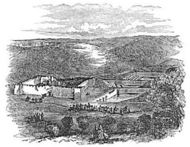
Among the most remarkable remains of antiquity in all Palestine are the three large reservoirs called Solomon's Pools. They are remarkable both for the labor and expense employed in their construction and for their durability. They are situated about two miles southwest of Bethlehem, at the head of a narrow valley called Wady Ur'tâs, which descends eastward past the Frank Mountain,19 and thence to the Dead Sea. The uppermost of the three is at the extreme head of the valley, the Hebron road from Jerusalem passing along its western side within a few feet of its wall. It is 380 feet long from west to east, 229 feet wide at the western end, and 236 at the eastern end. It is [222] dug down into the solid rock, walled with substantial masonry, and cemented. It is 25 feet deep, and was about half full of water in May, 1879. It has a flight of well-preserved steps six feet wide, descending to the bottom at the southeast corner, and along that side, as well as the western, the earth outside is almost on a level with the wall. Openings through the wall at the level of the outside surface admit the surface-drain in winter, but the surface which slopes toward the pool is of small extent. The wall is in a good state of preservation, except at the middle of the western end, where a section of it about 20 feet wide and 12 feet deep has fallen in and made quite a mound of earth and stones inside. The cement of this pool is much broken, and the deposit which has settled on the bottom supports a rank growth of moss.
The second pool is about 50 yards farther down the valley. It is much longer than the uppermost, and on account of the more rapid descent and widening of the valley it is much wider at the lower than at the upper end. Its length is 423 feet, its width at the upper end 160 feet, and at the lower end 250 feet. It is 39 feet deep at the lower end. Its bottom is not level like that of the one above, but slopes from the sides toward the middle with the natural slope of the sides of the valley. The entire bottom and sides are cemented, and the cement is in a perfect state of preservation,--not blackened with age, but fresh and clean. It has two flights of steps, both entering from the corners on the northern side. In the deepest part of the valley just above it there is a small circular reservoir apparently intended as a settling-basin for surface-water and for any which might overflow from the pool above. An opening through the wall of the pool near its top receives the overflow from the settling-basin. Thomson saw both this and the upper pool full of water and overflowing into the third.20
The lowest pool, which is much the largest of all, is about 50 yards below the second, and the perpendicular height of each of the upper two above its lower neighbor is about 20 feet. The lowest is 582 feet long, 148 feet wide at the upper end, and 207 feet at the lower end. It is narrower than either of the others, but much longer. It is also much deeper, being 50 feet deep at the lower end. Its bottom is composed of several layers of the natural rock dropping off like terraces toward the middle, and all well cemented. The cement on this, as on the middle pool, is well preserved and fresh in appearance. It also has a settling-basin at its upper end, and a broad flight of steps at its [223] southeast corner. It contained less water than either of the others in 1879, but a water-line distinctly traceable on the cement at the level of an overflow-channel near the top of the lower wall shows that it is often full. The other pools have no overflow-channel, showing that this one was expected to overflow more copiously or more frequently than the others. The lower end-wall of this pool, unlike the others, is almost entirely without support from earth outside of it, the more rapid descent of the valley at this point leaving it entirely above the surface. Consequently it is built with immense thickness, and is supported by an immense buttress in the middle. Under this buttress there is an arched passage passing through it, through the wall, and for a considerable distance under the bottom of the pool. A stream of water flows along the floor of the passage, coming from a spring under the bottom of the pool. The workmen who constructed the pool evidently found this spring in the bottom of the valley, and knowing that if they attempted to stop its flow it might eventually force its way through and cause a leak, they arched it over and gave its water a free passage under the pool into the valley below.
 |
| SOLOMON'S POOLS. |
The aggregate surface of these three pools is about 6¼ acres, and their immense capacity is realized when we observe that if they were thrown into one they would make a sheet of water 6¼ acres in extent, with a depth (taking the average of their greatest depths) of 38 feet. From this observation we also more fully realize the immensity of [224] labor involved in their construction, as well as the skill which has caused them to stand so complete and entire to the present day. Immediately north of the uppermost pool, and but a few yards from it, stands an old fortified khân, intended as a stopping-place for caravans and as a station for soldiers to guard the road and the pools. The cut on the preceding page presents an imperfect view of the pools, with the khân on the left.
The sources of supply for these reservoirs are almost as interesting as the pools themselves. That for the upper two is a fountain 220
 |
| SUPPLY-FOUNTAIN OF SOLOMON'S POOLS. |
About 12 inches from the bottom of the collecting-basin there is an outflow orifice towards the south, through which the water passes as it accumulates, leaving about a foot of water constantly in the basin. This outflow orifice leads into an arched passage, along the floor of which the water flows due south about 30 feet, where the passage turns into the direction of the uppermost pool. This passage, the mouth of which is seen in the right-hand side of our cut, is for a short distance three feet wide and eight or nine feet high; but thence it is narrower and lower. It is a trench cut into the natural rock, and covered with slabs of stone laid across the top, with the earth replaced above them. The water is the coolest that we found in all Palestine, except near the foot of Mount Hermon where the springs are supplied from the melting snow. It was probably collected thus deep under ground in order to protect it from the hot sun, and to keep it pure.
The water, thus springing from a fountain once concealed, and running down the slope through a hidden channel, makes its appearance near the northwest corner of the upper pool in a well. On a platform of rock, elevated a few feet above the surrounding surface, is a well's mouth, the stone curb of which is worn into scallops four inches deep by the abrasion of ropes used in drawing water. This opening passes through the vaulted ceiling of a chamber below, in the bottom of which the water from the fountain above described is collected in a round well, and stands three feet deep. From the top of the well-curb to the bottom of this shallow well is 27 feet. The chamber is reached by a narrow flight of stairs descending from the platform. [226] On the south side of the platform is a long stone watering-trough for the use of passers-by.
The water from the fountain-head before descending into this well first enters a small distributing basin only six feet beneath the surface. It is a circular stone basin about three feet in diameter, with an orifice at one side, through which a part of the water flows to the uppermost pool, and another by which the remainder of the water flows into the chamber and well just described. Thence a still deeper underground channel conducts it along the northern side of the uppermost pool to another distributing basin, about six feet under ground, close to the corner of the middle pool. Here the stream is again divided into two, one of which continues down the valley, and the other runs into the adjacent pool. Thus it appears that these two pools are supplied by a constant flow of part of the water from the fountain. At each of the distributing basins it would be the work of but a moment to stop up the channel leading into the pool and turn all the water into the aqueduct, or that leading into the aqueduct and turn it all into either pool. In both pools, at the corners nearest the distributing basins, the water can be seen flowing in.
The third pool receives no water at all from the aqueduct. Its supply is from another aqueduct coming from the south, which starts from Wâdy el Beer (valley of wells), about 3½ miles distant. A hill about 100 feet high rises from the southern side of the lowest pool, and the aqueduct, after winding around the southern slope of this hill, to a point nearly half way up the hill and opposite the middle of the pool, empties into an open stone channel which runs straight down the hillside and empties into the pool over the top of its wall. No water was flowing through this aqueduct in May, 1879. Its fountain had run dry, or the aqueduct had been broken. In consequence of this failure of its usual source of supply, there was less water in this pool than in either of the others.
The aqueduct already described as supplying the two upper pools is the beginning of Solomon's aqueduct. It conveys water to Bethlehem and Jerusalem, and its construction has been ascribed, like that of the pools, to Solomon. It is a very common mistake of writers and travelers to represent these pools as supplying the aqueduct, and also to represent each upper pool as supplying the one below it. The pools have no connection with one another; the lowest has no connection at all with the aqueduct, and the upper two, instead of supplying the aqueduct, receive their supply from it. The pools were evidently intended for the storage of a vast quantity of water, which might be [227] used to irrigate the fields in the valley below, and, in case of necessity, to temporarily supply the aqueduct. There is no indication, however, that a connection for the latter purpose was ever established.
The aqueduct, after supplying the second pool, continues down the slope of the valley past the third pool, and a short distance below the northeast corner of this latter pool it receives an addition to its current by the entrance of another aqueduct from the south, which crosses the valley on a low wall. The author traced this latter aqueduct to a small opening in the ground about 200 yards distant, through which he clambered, and found a small rock-cut chamber, with an arched roof, into which the stream finds its way, and whence it flows into the aqueduct. This chamber is 21 feet long, 11½ feet wide, and 9 feet high. The opening by which I gained admittance was made by the falling of a stone from the arch of the ceiling near its northern end. The stream flowing hence is weak, but ere it reaches the principal aqueduct it receives the one which flows from under the third pool, and the two together make a considerable addition to that in the aqueduct, compensating it for the loss of the water which supplies the two upper pools. The basins in which these streams unite with one another are open to the air, and are examined without difficulty. From the point of their intersection the principal aqueduct may be said to fairly start on its way to Jerusalem. Thus far it has descended by a steep slope nearly 100 feet below its fountain-head, but in the remainder of its course its fall is barely sufficient to give its water a steady flow.
It winds around the sides of the hills on a bench cut for it, and this bench is a good roadway as far as Bethlehem. The mode of construction was first, after cutting this bench, to lay down a course of stone slabs for a foundation. On these were laid the earthen pipes to convey the water, their ends fitting into one another and being made water-tight by cement. Then, for the protection of the pipe, it was covered with stones of irregular shape laid in a mass of cement. The pipe is about eight inches in interior diameter. At intervals along the way to Bethlehem there are square openings in the top that serve as drinking-places for passing men and animals, and they can be utilized for the purpose of irrigation. A board slipped down on the lower side of the opening, so as to obstruct the flow, or a bunch of straw stuffed into the orifice below the opening, would cause the water to overflow and spread itself over the hillside and valley below, or to run into irrigating channels in any direction. On reaching the southeastern suburb of Bethlehem the aqueduct passes [228] through a kind of cistern, which it keeps supplied with water for public use. On the northern side of the hill on which David's Well is situated, a woman brought the author a drink of water from one of its openings. The aqueduct lies by the side of the road leading from Jerusalem to Bethlehem at many places; it crosses the Valley of Gihon, as formerly remarked (page 202), on arches built for its support, and for that of the Bethlehem road which crosses by the side of it; thence it winds around the southern and eastern sides of Mount Zion to the point at which David Street crosses the Tyropeon Valley to the temple mount; crosses the same valley under that street, and enters the temple mount. Its connections within that mount must remain unknown until the Turkish authorities shall allow the excavations to be made which are necessary to the unveiling of its mysteries. At the crossing place of the Valley of Gihon the author found a small opening broken into the top of the aqueduct, into which he inserted his hand and found the pipe nearly full of water.
The generally received opinion that the pools and aqueduct just described were constructed by Solomon, has been called in question by some recent explorers, among whom is Lieutenant Conder, who expresses the opinion that both were constructed by Pontius Pilate.22 The same opinion is expressed in Baedeker's Handbook (254), and it is based on statements made by Josephus. This author says in his work on the Jewish War,23 that Pilate raised a disturbance among the Jews "by expending that sacred treasure called corban upon aqueducts, whereby he brought water from the distance of four hundred furlongs." But in describing the same incident in his Antiquities24 he uses the following language: "But Pilate undertook to bring a current of water to Jerusalem, and did it with the sacred money, and derived the origin of the stream from the distance of two hundred furlongs. However, the Jews were not pleased with what had been done about this water; and many ten thousands of the people got together and made a clamor against him, and insisted that he should leave off that design." Here the distance is stated at half what it is in the other book. Perhaps in the former statement he meant the distance measured along the aqueduct, and in the latter the distance in an air-line. But 400 furlongs, 50 miles, is four times the length of the aqueduct in question, and 200 furlongs, 25 miles, is three times the distance to the head of this aqueduct. Twenty-five miles would reach far beyond the [229] range of hills high enough to send a current of water to Jerusalem. It must, then, be an exaggeration; and it would be so enormous if the reference were to this aqueduct, that we must suppose he referred to some other. Again, the fact that the existing work conveys water to the sacred precincts of the temple, points not so much to a heathen procurator for its origin, as to a religious king like Solomon. Furthermore, the extensive system of cisterns and reservoirs within the temple inclosure, evidently demanding and contemplating some such source of supply, points to the builder of the temple as the constructor of the aqueduct, seeing that without it the temple would have no water except from the rainfall on its own premises. Again, that Solomon did construct pools of water worthy of being mentioned among the great achievements of his reign, he himself asserts in the well-known passage, "I made me pools of water, to water therewith the wood that bringeth forth trees."25 The pools at the head of this aqueduct answer well to these words, and there are no others in all the land so worthy of being thus mentioned. They must have been intended primarily for the purpose of irrigation, and only secondarily, if at all, for the supply of the aqueduct. There is no little confirmation of this view in the statement made by Josephus, that "There was a place about fifty furlongs (six miles) distant from Jerusalem, which is called Etham; very pleasant it is in fine gardens and abounding in rivulets of water; thither did he [Solomon] use to go out in the morning sitting on high in his chariot."26 This place was in the vicinity of Bethlehem and Tekoa, as appears from 2 Chron. xi. 6, where it is said to have been fortified by Rehoboam, the son of Solomon. The ruins of such a town are now seen a short distance below the pools. In the light of these considerations it seems best to retain the former opinion that the pools are almost certainly the work of Solomon, and that, while it is possible that some one else may have constructed the aqueduct, it is more likely that this also is the work of him who built the temple, and who could not have left it unsupplied with water.
The preceding conclusion is strengthened by the fact that another aqueduct, called the Stone Aqueduct, has been discovered and traced, which answers much better to the description of Pilate's work given by Josephus. A short piece of it has long been observed by travelers a few hundred yards east of Rachel's tomb, and Dr. Barclay discovered other pieces near the convent of Mar Elyas (see page 215) and on the Plain of Rephaim. He ascertained that it is on a level sufficiently [230] nigh to reach the upper pool of Gihon, and to run water into the moat of the citadel; and he concludes that its water is referred to by Josephus when he speaks of water that was brought into the tower of Hippicus.27 It was made of cubical stones perforated with a bore six to eight inches in diameter, with a conical point on one fitted into a conical opening in the next, and made water-tight by cement. Lieutenant Conder, in his careful survey of the country, traced out much more of its course and found its fountain-head. While camped three miles north of Hebron, 3300 feet above the level of the sea, he found on another hill north of his camp the head of this aqueduct. It is "thirteen miles from Jerusalem as the crow flies, and forty-one and a half by the aqueduct, the fall being 365 feet."28 This is doubtless the fountain referred to by Josephus in the quotations above made from him (page 229), and it appears that while his 200 furlongs, 25 miles, is about double the distance in an air-line, his 400 furlongs, 50 miles, for the length of the aqueduct itself, is only 8½ miles out of the way.
§ IV.
TOWARD THE DEAD SEA AND THE JORDAN.
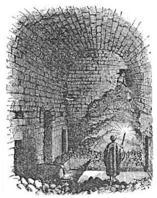
The valley of the Kedron, after running nearly due south for about a mile below the city, turns abruptly to the southeast, and thence passes on to the Dead Sea, growing deeper, narrower, and more desolate as it advances. On its southern side, about nine miles from Jerusalem, is the ancient Greek convent of Mar Saba, Saint Sabas. About the middle of the fifth century this saint took up his residence here in a cave which had been occupied by a lion. One day the saint came in and found the lion at home. He said his prayers, so the story goes, then laid himself down and went to sleep. The lion twice dragged him out, but he persisted in returning, so the lion submitted to the intrusion and both lived together in peace until the lion died. The monastery was built over the cave, though it had to be fastened to the side of an almost perpendicular bluff 590 feet from the bottom of the gorge. It has been frequently pillaged and partially ruined in the course of ages, but it was thoroughly repaired by the Russians in 1840. It is regarded with the greatest veneration by the Greek Church. It is now occupied by about 40 monks, who live entirely upon vegetable diet, and have no communication with the outside world, except when [231] travelers call to visit their strange abode. No woman is admitted within the walls on any pretext whatever. The monks have preserved the skulls of their deceased brethren, and the chamber in which they are kept is said to contain 14,000 of them. It would be impossible to convey to the reader a clear conception of the building itself by a mere description. It is made up of an "odd mixture of natural rock and masonry," and Dr. Bartlett aptly compares it, when seen at a distance, to "a nest of swallows in the side of a huge sand-bank or a wasp's nest glued to a rock."29 From the convent it is but a short ride to the northern end of the Dead Sea, and many travelers take this route to the sea, returning to Jerusalem by way of Jericho.
If, on leaving Jerusalem by St. Stephen's gate, and crossing to the Garden of Gethsemane, we pass along the right-hand side of that inclosure, we are on the road to Jericho. It passes along the front of the Mount of Olives, gradually ascending, winds around its southern slope about 100 feet below its summit, and crosses a depression which connects that mount with the Mount of Offense. The road then descends about 100 feet, curves to the left to pass the head of a gorge, ascends again along the southern slope of the southeastern spur of the Mount of Olives, winds around to the eastern side of this spur, and passes by Bethany, which it leaves on the left. This village is called by the Ar'abs el Azarîyeh, a name derived from Lazarus. The village consists of 30 or 40 miserable hovels, inhabited only by Ar'abs. Its most conspicuous object is part of an ancient tower built of drafted stones, the origin of which is not known. Churches and monasteries were erected here at an early period, but they have all perished. The traveler is led down a flight of 26 stone steps, all leading underground through the solid rock, to behold the tomb whence Lazarus was called from the dead. There is nothing visible which resembles a Jewish sepulchre, and if the cavern in which Lazarus was buried is still in existence at all it is far more likely that it is one of many caverns outside the village to the south and southeast than in the very heart of the village itself.
A foot-path runs from Bethany in almost a direct line to the top of the Mount of Olives. It is much shorter than the road described above, and it would be chosen by footmen and by persons with unloaded animals going into the city, but on account of the steep ascent of the Mount of Olives it would be avoided in coming out of the city. It was doubtless followed by Jesus in his triumphal entry and in his [232] usual walks into the city from Bethany, but he returned by the other road. This accounts for the fact that when he cursed the fig-tree on his way into the city, the disciples did not discover that it had withered until they were going in again the next morning; they missed seeing it in the afternoon because they took the other road.30
On the right hand of this path, as it nears the top of the Mount of Olives, the foundations of a house have recently been uncovered, which many suppose to mark the site of Bethphage. If this identification should prove to be correct it will make certain the supposition that Jesus followed this route in his triumphal entry.
The road after leaving Bethany soon ascends a hill on which Martha is supposed to have met Jesus,31 and then about a mile farther it descends into a narrow valley called Wady el Hôd (valley of the watering-place), in which about a mile farther we find a fountain. This is probably the "waters of En-shemesh," mentioned in the southern line of the tribe of Benjamin,32 and near here must have been Bahurim, for as we approach the fountain the road passes along the back of a descending ridge with one much higher to the left separated by a narrow valley. As David passed along the former Shimei could have passed along the latter, throwing stones and hurling curses, while Abishai was chafing to go over and take off his head.33 The fountain sends forth a stream from an orifice three feet from the ground. The temperature of the water in April, 1879, was 75°. A winter torrent flows along the bed of the valley, and the road crosses it a short distance below the fountain. This is the brook of water referred to by the woman of Bahurim when, having hid Hushai's messengers to David in her well, she told the pursuers that they had gone over "the brook of water."34
From this point the road continues to descend, with now and then a short level stretch, and it is very rough. In places the lower side of the road as it passes deep ravines is supported by a wall, and in others the torrent bed crosses it. There are evidences everywhere of a great rush of water along the torrent beds during the winter rains.
About half way to Jericho the road crosses the saddle of a high ridge in passing from one wady to another, and here is the traditional site of the parable of the Good Samaritan.35 On the right-hand side of the road there is a perpendicular overhanging rock, with a shallow [233] cavern excavated in its side, which affords the only shade in the vicinity, and furnishes a favorite lunching-place for travelers. Across the road, on the north, are the ruins of an old khân, 150 feet square, with two immense cisterns near the centre. One of these is caved in, but the other still holds water, and from it the animals of passing caravans are watered. On a high hill, a short distance to the northeast of this khân, are the ruins of an old fortification, strongly built, with a deep ditch around it cut in the natural rock. It was built to make secure for travelers a road which has been more noted for the depredations of robbers than any other road leading out from Jerusalem. It was on this account that the scene of the parable of the Good Samaritan was located on this road.
After crossing the ridge just mentioned the road descends more rapidly, but the hills descend more rapidly still. All is wild and desolate. The road bed has been often shifted by the violence of the winter torrents, and, though often repaired, it is still in some places scarcely passable for loaded animals. Several Europeans of wealth have in the last few years, after passing over it, appropriated considerable sums of money for its partial improvement. It is utterly impassable for wheeled vehicles. When within about three miles of the Jordan Valley you see Wâdy Kelt, a deep, wild gorge, a short distance to the left; and when within about a quarter of a mile of the valley you pass along the edge of the precipice which forms the southern side of this chasm. It is the darkest and most desolate looking gorge in all Palestine. On either side is a perpendicular wall of dark-brown rock, having a rotten and crumbling appearance, and the narrow bottom of the chasm lies more than 2000 feet below the road. A noisy stream dashes along its rocky bed, distinctly heard on the road above, and a narrow line of verdure marks its course. On one occasion the author entered this gorge at its mouth, where it breaks out into the plain, and ascended it about a mile, partly on horseback and partly on foot. It is scarcely possible to conceive the wild and desolate grandeur of the place. Its brown walls are only about 20 yards apart, and they rise so high and steep as to shut out all the sky, except a narrow strip overhead. There is no reason to doubt that it is the "brook Cherith," in which Elijah was hidden and fed by ravens until the brook ran dry.36 It is the only brook "before Jordan" suitable for such concealment. The stream flowing through is sometimes a violent torrent, as appears from the large rocks in its bed, broken and rounded by the rush of the [234] water. Conder saw it swelled by rain in a quarter of an hour till it was in places 8 or 10 feet deep.37 The wâdy heads near the road from Jerusalem to Bethel. Nearly four miles above its mouth are the remains of a magnificent aqueduct, which once conveyed a portion of its water along a higher level for the purpose of irrigation. That portion of the wâdy which flows through the Jordan Plain will be described in connection with the localities in that plain, Chapter VIII., § 1.
§ V.
IN THE HILLS OF BENJAMIN.
There are three frequented routes from Jerusalem leading northward across the highlands of the land of Benjamin,--the central ridge road leading directly to Bethel, Nablus, and Galilee; a road starting from the northeast corner of Jerusalem and passing in a northeasterly direction to Michmash; and another turning to the left from the first mentioned road about a mile north of the city, and running northwest to Mizpeh and Gibeon. In starting for the latter points, however, one may go out the Joppa gate and pass between the city and the Russian property. We will follow these three routes separately in mentioning the localities reached by them, beginning with the northeastern, which is nearest to the line last pursued.
The road from the northeast corner of Jerusalem descends into the upper and broader parts of the Valley of the Kedron, and thence, running northeast, climbs the ridge of Scopus. Here a path turns to the right, and leads to a small village called El Isâwîyeh, supposed to be the site of the ancient Nob.38 Avoiding this path and crossing a wâdy (Wâdy Sulêm') to the next ridge, we come to Anâ'ta, the ancient Anathoth, which is about three miles northeast of Jerusalem. It is a village of mean houses nestled among the ruins of better buildings. Tombs, broken columns, and ruined walls are seen on every hand, and well-shaped building stones are seen here and there in the rude stone fences. The village is occupied by about 20 families, and they are planting young orchards of figs and olives.
Beyond Anathoth the road crosses another narrow valley with steep sides, and then descends into Wâdy Fâra, a rich and well-cultivated valley, containing some excellent springs. This wâdy descends into Wâdy Kelt (the Cherith), and its springs are tributary to the stream [235] which flows along the bed of the latter. Dr. Barclay thought that he discovered in this wâdy the fountains of Enon where John baptized, some half-dozen springs along its course supplying a stream in which he found many natural pools from two to six feet deep;39 but Enon has since been identified on Wâdy Far'rah, a stream running from Mount Ebal to the Jordan. See Chapter V., § 2. Beyond this valley, and on an eminence reached by a long slope covered with well-cultivated fields, is Jebâ', the ancient Geba.40 It is about such a village as Anâ'ta, except that it is more populous. It is about six miles from Jerusalem.
Looking north, and a little east from Jebâ', we see Michmash, a similar village, about two miles distant, with a deep valley called Wady Suwei'nît lying between. The side of this wâdy next to Jebâ' can barely be descended on horseback, and about a mile eastward of the line between the two villages it becomes so narrow and deep that the opposite heights are not a mile apart in an air-line, though the gorge between them is nearly 1000 feet deep. At this point must have been stationed the armies of Saul and the Philis'tines previous to the famous feat of Jonathan and his armor-bearer, which resulted in a disastrous rout of the Philis'tines.41 Saul, with his 600 men, was on the south side of the valley, with Geba on his left, while the Philis'tines were on the north side, with Michmash on their right. The author descended the valley in front of Geba, and then rode along its crooked torrent-bed, covered with large rounded boulders, until he came between the positions of the two armies, and found that the locality corresponds precisely to the description given in the text of Scripture. It is said that "between the passages by which Jonathan sought to go over to the Philis'tine garrison there was a sharp rock on the one side and a sharp rock on the other side; and the name of the one was Bo'zez, and the name of the other Se'neh." There they were,--a precipice corresponding to Se'neh, about 100 feet perpendicular, surmounted by the slope of 800 or 900 feet more, rising up to Saul's position, and one corresponding to Bo'zez, on the opposite side, about 50 feet high. A little west of the southern precipice, about where the left flank of Saul's little army would be posted, is a descent sufficiently gradual for a man to come down, and it might possibly be descended on horseback. There Jonathan must have come down into the deep, narrow bed of the gorge, where he would be invisible to both armies. Then, moving 100 or more yards down the gorge, there is a break in the precipitous face [236] of Bo'zez, up which he could climb on his hands and feet, as he did, to the line of the Philis'tine sentinels. There are many excavations, either natural or artificial, in the face of the cliffs, and probably these suggested to the Philis'tines, when they saw the two men climbing up, the remark, "Behold, the Hebrews come forth out of the holes where they had hid themselves."42 When the retreat of the Philis'tines began they must have fled westward past Michmash, while Saul's army, in pursuit, rushed westward past Ge'ba, headed the valley, and fell into the rear of the retreating Philis'tines.
From the eminence on which Jebâ' is situated the eye surveys an extensive range of hills crowned with many villages in every direction except the east. In that direction it stretches over the barren ridges descending toward the Jordan, and the view is bounded by the mountain-wall east of the Jordan. Many of the villages in view, and some of the largest, are not mentioned at all in the Scriptures, and will therefore be omitted from these pages.
If we take the central road from the Damascus gate to the north, after crossing the ridge of Scopus we find ourselves in the midst of localities belonging to ancient Benjamin, which lie thick on every hand. About a mile beyond Scopus, and a short distance to the left of the road, is the well-built village of Shafât'. It is constructed of ancient material, and doubtless occupies an ancient site; but it is not identified with any ancient town. It contains the ruins of a church, and a small reservoir hewn in the rock.
To the right of the road nearly opposite Shafât' is a conical hill which has been regarded by many as the site of Nob. There is no ground for this opinion, other than the fact that this village of priests must have stood somewhere in the vicinity of Gibeah, which is near by. For another tradition in reference to its site, see page 235.
Just north of the last mentioned hill, and not a mile distant, is another conical hill called Tuliel' el Fûl, which has been identified ever since the researches of Robinson as Gibeah of Benjamin, and also Gibeah of Saul, if these two places are to be regarded as identical,--a question not fully settled. Its area on top is much more extensive than that of the last mentioned hill, its sides are marked by broad terraces, and some ruins are seen on its top. When well fortified it was a strong place, and well adapted to the defense made by Benjamin, as described in the twentieth chapter of Judges. It was also well situated for the capital of Saul's kingdom, with the exception that it can [237] never have been well supplied with water. This may account for the fact that in all of Saul's wars, though sometimes compelled to retreat from the Philis'tines, he never allowed himself to be besieged within his own capital, as did the kings who reigned in Jerusalem and in Samaria. It is about three miles from Jerusalem.
After leaving Gibeah the western view from the road is more extended, and the three villages of Bêt Iksa, Bêt Hanî'na, and Bir Nebâ'la are visible. Indeed, the entire hill country of Benjamin through which we are passing, though an exceedingly dry, rocky, and hilly district, is thickly set with villages, as much so as any part of the country. The soil on the hillsides and in the valleys is exceedingly rich, and the villagers find a ready market for their products in Jerusalem. About three miles north of Gibeah, and six from Jerusalem, a high hill rises from the tight side of the road, crowned with the village of Er Râm, identified by its name and its site with Ramah, once a frontier town near the border between the kingdoms of Judah and Israel.43 It is a small village built among ancient ruins, many of the tenements being rooms in ruined buildings, while some are huts built of ancient material, and some are caves in the hillsides, once used apparently as sepulchres. Like all the other eminences in this region it commands an extensive and interesting view of surrounding hills, valleys, villages, and mountains. At the foot of the hill where the road passes are the ruins of an ancient khân.
Nearly two miles beyond Ramah is a ruined village called Kîr'bet el Atâr'a, ruins of Atâr'a, the ancient Ataroth, a town on the border between Benjamin and Ephraim.44 There are here two pools for the preservation of water through the summer drouth. About a mile farther we come to El Bîr'eh, the biblical Bé'eroth, one of the cities of the Gibeonites in the days of Joshua, whose inhabitants deceived Israel into the belief that they lived a great way off, and thus induced the officers to make a treaty with them.45 It derives its name (cistern) from its good supply of water. A very copious spring at the southwestern corner of the village, where the road going north first strikes it, furnishes an abundance of water for all purposes. The water is made to rush out through a pipe from the side of a low stone building which covers the spring. It falls into a stone trough, at which animals are allowed to drink, and the women, who resort hither in large numbers for water, fill their water-skins and jars by holding them under the spout. A short distance below the spring is a large reservoir of fine masonry, now disused [238] and nearly filled up with mud. The valley immediately south of the village is well cultivated, and young vineyards and fig-orchards have recently been planted there. There is also a recent increase of the area cultivated in grain. The village contains about 800 inhabitants, being the largest thus far met with on the road from Jerusalem. Its stone houses are mostly built of material from ancient ruins, declaring that it stands on the site of a well-built ancient city. The same is true of nearly all the other villages.
The next place of importance, going north, is Bethel, now called Beitîn'. It is 12 miles north of Jerusalem, and from the hill on which it stands Jerusalem is distinctly seen. It occupies the southern slope of a very rocky hill, and the region immediately about it is the most rocky spot thus far seen on the road from Jerusalem; but the soil is rich where any can be found, and grain grows luxuriously where the surface of the ground is almost hidden with stones. Young orchards of figs abound and freshly-planted vineyards, while stone walls recently thrown up on the borders of the little fields show that vigorous efforts are being made to extend the tillable area. The inhabitants are estimated at 400, and they dwell in houses, like those of El Bîr'eh, chiefly built of material from the ruins of better buildings. It contains the ruins of an ancient tower and an ancient church. At the foot of the hill just south of the village is a spring which rises within a pool about to feet wide by 12 long, and six feet deep. The pool stands full of water, and a feeble stream flows from it into a valley to the southeast. Just below the pool is a large reservoir, partly cut in the rock, with a solid rock bottom exposed in one part. The southern and eastern walls are still standing, showing that the reservoir was originally about 10 feet deep, and its dimensions are 317 by 214 feet. A rich piece of ground southwest of the pool containing four or five acres was being set with tomato-plants when the author was there in May, 1879, and many women and boys were carrying water from the pool with which to water the plants as they were set.
Immediately east of Bethel is a higher ridge, separated from the one on which Bethel stands by a narrow valley which descends towards the south, deepening rapidly as it goes. This is the "Mountain east of Bethel" on which Abraham pitched his tent. The spot on which the tent is likely to have stood is marked by a ruined tower, which, as appears from broken capitals built into its walls, must be a reconstruction from some still more ancient building. A small space around it is inclosed by a stone wall, and within this, to the west of the tower, is a fine rock-hewn cistern. A short distance to the southeast is a [239] sepulchral cavern. Beyond this mountain to the southeast, and separated from it by a shallow depression, is another, with a rounded top covered with ruins. This appears to be the site of Ai. It corresponds to the description in Genesis xii. 8, which states that Abraham removed to a "mountain on the east of Bethel and pitched his tent, having Bethel on the west and Ai on the east, and there he builded an altar to the Lord." With his tent on the spot above mentioned Bethel was almost due west from him, and Ai southeast. This site also corresponds to the account of the capture of Ai given in Joshua viii. 9-19. Just north of it, separated from it by a valley with a gentle slope on each side, is a ridge on which Joshua's army may have been drawn up, while west of it, sufficiently near the direction of Bethel to be described as "between Bethel and Ai," is a deep valley in which the 5000 men in ambush could lie hid from both cities. Joshua may have stood on a hill nearly due east of Ai, in full view of the city and of his own army, yet also visible to the right flank of the detachment in ambush, and have given the signal to the latter by lifting up his spear. No other spot in the vicinity answers so completely the demands of the Scripture narrative, so here we must suppose that Ai stood. With Ai and Bethel in full view, while Bêeroth is only two miles away, and Gibeon only three or four miles farther, we are in the midst of stirring scenes connected with the careers of men as far apart in history as Abraham, Jacob, Joshua, David, Jeroboam, and Josiah. It was in this vicinity that Abraham and Lot separated after Lot had "lifted up his eyes and beheld all the plain of the Jordan, that it was well watered everywhere, before the Lord destroyed Sodom and Gomorrah;"46 but if the historian is not here speaking of what Lot saw in his mind's eye, remembering what he had seen before, he must have traveled a number of miles to the east in order to obtain the view, for from no hill-tops in the vicinity of Bethel and Ai can any part of the plain of the Jordan be seen. He may have taken several days to look around, after the generous proposal of his kinsman, before he made his choice.
A few miles northeast of the site of Ai is a village called Rammûn', supposed to occupy the site of Rimmon, the place to which the 600 Benjamites fled after the disastrous battle described in the twentieth chapter of Judges. It is loftily situated on a rocky eminence with steep slopes on every side. Farther to the north is an important and flourishing Christian village called Tai'yibeh, which is without a Scripture history. The author visited it, and found ruins of [240] several churches within and near it. It is surrounded by olive and fig orchards, and the soil is well cultivated by the villagers. Our dragoman purchased from them a supply of dried figs for our table. Still nearer to the supposed site of Ai is the village of Dêr Diwân', also without mention in the Scriptures.
That portion of the land of Benjamin which lies west of the route last pursued can be described to the best advantage by making Neby Sam'wîl our point of observation. This is a conical hill about five miles northwest of Jerusalem, the loftiest and most conspicuous point in this part of Palestine. It is one of the first objects which become familiar to the eye of the traveler. It is 3006 feet above the level of the sea, being about 400 feet above the highest part of Jerusalem. It is almost universally regarded by recent explorers as the ancient Mizpeh (watchtower), and there is no spot in the land of Benjamin to which the name is so appropriate. Since the time of the Crusades it has been supposed, without reason, to be the burial-place of Samuel, hence the Arabic name Neby Sam'wil, the prophet Samuel,--for the Ar'abs have accepted this tradition, as they have many others, from the Christians. The summit is crowned by a dilapidated mosque, once a Christian church, within which is shown a comparatively modern Moslem tomb as the tomb of Samuel. From the top of the minaret, which is reached from the roof of the mosque, is obtained one of the most extensive and interesting views in all Palestine. Jerusalem is in full view, together with all the more prominent objects about it, and multitudes of hills and villages full of historical interest are seen in the wide sweep from the southeast to the north; while to the westward the eye ranges over the descending slopes of the western hills, beyond which are the broad stretches of the Plain of Sharon; and the horizon is limited in this direction by the mist which hangs like a gray cloud on the surface of the Mediterranean and hides its water from the view. The village occupies the narrow top of the hill, and consists of a few small stone buildings whose walls are partly composed of masses of natural rock left projecting above the surface, the remains of the ancient fortification. On the eastern slope below the village are two reservoirs hewn in the rock, which were supplied partly by rain and partly by a spring a little farther around the hill to the north. On the southeast the mountain descends into a beautiful valley called Wâdy Hanî'na, from a village of this name at its head about two miles to the east. It here curves to the south, grows rapidly deeper and narrower as it advances, and finally turns westward and merges into the Valley of Sorek, which debouches into the Philistine Plain after passing [241] Beth'shemesh. It was along the bed of this valley that Samuel and the Children of Israel chased the Philis'tines during the battle of Ebenezer.47
Immediately to the north of Neby Sam'wîl, with a smooth and beautiful valley lying like a basin between, rises the hill of El Jib, the ancient Gibeon. The hill is not so high as that of Neby Sam'wîl, yet it is a lofty eminence, with a steep but smooth slope in every direction. The stone village is built of ruins, and in the midst of it are the remains of what appears to have been an ancient castle. On the northeastern slope of the hill is a copious fountain of fine water in a shallow cavern, which is reached by descending a few stone steps. Below the fountain are two reservoirs, a larger and a smaller. Not feeling satisfied that either of these appeared sufficiently ancient to be the pool of Gibeon mentioned in the account of the battle between Abner and Joab,48 the author made search for another; and by the guidance of an old man of the village, after riding through vineyards and over stone fences, and at last dismounting, we reached a more ancient pool on the southeast slope of the hill, which is now nearly filled up and cultivated in vegetables. A feeble spring above it once supplied it with water, and is now used to irrigate the garden of vegetables. The smoother and broader plain below it makes this a more suitable place for the battle.
To the northwest of Gibeon, and about a mile distant, is the head of the pass, descending by the two Bethho'rons into the Plain of Sha'ron, on the ancient road to Joppa and Cæsarea. In the midst of this pass, and on a rocky point which divides it, stands the village called Bêt Ur el Fo'ka, the ancient Upper Bethho'ron. Below, at the bottom of the pass, is Bêt Ur el Tâh'ta, the Lower Bethho'ron, about three miles distant. It was in the vicinity of the former of these places that Joshua stood, when, in his pursuit of the army of the Canaanites, he exclaimed, "Sun, stand thou still upon Gibeon; and thou, Moon, in the Valley of Ajalon."49 At eight or nine o'clock in the morning the sun would from this point seem to hang over Gibeon; and if the moon was just entering its last quarter it would hang over the Valley of Ajalon, which stretches away to the southwest, passing the village of Latrûn'.
The ancient road through this pass continued to be the frequented route between Jerusalem and Joppa until, in the year 1872, the present turnpike was constructed from Joppa to Jerusalem by a more direct and shorter route. [242]
§ VI.
IN THE WESTERN HILLS.
The reader can best obtain a conception of the localities in the hills westward of Jerusalem by following the roads which lead in that direction. These are the Joppa road, which runs to the north of west; that to Ain Ka'rim, which runs nearly due west; and the ancient Gaza road, which runs southwest.
About four miles from Jerusalem, on the Joppa road, is a broad valley, which is reached by a descent of about 800 feet from either side. It is called Wâdy Kulônî'yeh; but it is a continuation of Wâdy Hanî'na, which heads to the east of Neby Sam'wîl, and it is the upper part of the Valley of Sorek. The road descends into it from either side by a series of zigzags. The torrent bed is crossed by a bridge, and near the bridge is an Ar'ab café, where it is customary for travelers to stop and lunch, eating their own provisions. The village is just north of the café and was once supposed to be the site of Emmaus, but it is much nearer Jerusalem than Emmaus was.50 The road between Jerusalem and this place passes through the roughest and dreariest portion of its entire route to Joppa. It passes by only one spot mentioned in the Scriptures, a village called Lifta, supposed to be the ancient Neph'toah, two and a half miles northwest of Jerusalem.51
Passing on westward from the Valley of Sorek, when we reach the summit of the hill on its western side, and turn our eyes to the southeast, we have a fine view of the convent and village of Ain Kar'im, to be described below. This is one of the most pleasing views on the entire road from Jerusalem to Joppa. About a mile and a half farther west the road passes along the southern slope of a rounded hill with some ruins on its top, supposed to be the site of the house of Obed-edom, where David left the ark for three months after the death of Uzzah.52 As it is on the road from Kirjath-Jearim to Jerusalem, along which the ark was being moved, the identification is not improbable.
About a mile and a half still farther west, which is about seven miles by the road from Jerusalem, is the village called Abu-Gôsh, which is identified with Kirjath-Jearim, the place where the ark rested from the time of its return out of the land of the Philis'tines until its removal to Jerusalem by David.53 Its present name (Father Gôsh) is of recent [243] origin, being derived from that of a village shêikh who, with a band of followers, led the life of a marauder for many years, and was the terror of the surrounding country. During the early part of Dr. Barclay's residence in Jerusalem, he witnessed an assemblage of the forces of this chieftain at the fountain of Neph'toah, and the inhabitants of Jerusalem were closely confined within the walls for some months on account of the warfare going on between him and his enemies.54 The most notable object about the village at the present time is the well-preserved ruin of a church standing between it and the road. It is one of the very few churches of the old Christian period which have not been converted into mosques. A fine spring to the southeast of the church supplies the village with water.
The last point of special interest on this road before descending into the Plain of Sha'ron is Latrûn, situated on a hill to the south of the road, about half way between Jerusalem and Joppa. It is a very small village composed of miserable hovels among the ruins of massive buildings which once covered the top of the hill. Many arches, vaults, and foundation-walls of the ancient city are yet seen, and the view from the summit is commanding. On a bench of the hill, near its northern foot, and but a short distance from the road, is a comfortable building two stories high, erected in 1878 as a wayside hotel for the accommodation of tourists. It is clean and comfortable, and was built of stones taken from the ruins of Latrûn. A short distance west of the hotel is a good spring with a small reservoir adjoining it. Latrûn derived its name from a tradition that it was the home of the penitent robber (latronis in Latin) who was crucified with Jesus. There is also a tradition that Judas Maccabeus and several members of his family were buried here, and a sepulchral cavern near the hotel is pointed out as the place of their burial.
Other localities on the road to Joppa and to the right and left of it will be described among the places on the Plain of Sha'ron.
About a mile and a half a little south of west from Jerusalem is a Greek monastery called the Monastery of the Cross, founded in the fourth or fifth century, and now containing a seminary for the education of priests, with six professors and about sixty pupils. It has a large library containing some ancient manuscripts. The grounds are well cultivated, and the buildings, recently repaired, present a pleasing appearance.
About four miles due west of the city is the convent of St. John the [244] Baptist, a Latin convent, so called because it is supposed by its owners to occupy the site of the house of Zachariah, the birthplace of John the Baptist. The buildings are handsome, the surrounding wall incloses a garden in which grow some tall cypress-trees, and the village of Ain Kar'îm, standing just below, is a well-built stone village containing about 600 inhabitants. The village derives its name from a spring which furnishes it with water. It occupies the western slope of a mountain which descends into the Valley of Sorek. The country round about it is exceedingly rough and mountainous, but the soil in the valleys and on the slopes is productive.
The Monastery of the Cross, just mentioned above, fronts to the south, and the slope in its front is the northern side of the Wâdy el Werd, the Valley of Roses, which drains the Plain of Rephaim. It is so called because several acres of ground here are cultivated in roses, and have been for many years back,55 for the purpose of making rose water. On the farther slope of this valley, and about four miles southwest of Jerusalem, is the village and fountain of Ain Yâlo. A pool 20 feet square, and entered by a flight of steps at one corner, receives the surplus water from the spring. A little more than a mile farther down the same valley, and consequently about five miles from Jerusalem, is another spring called Ain Hanî'yeh, Philip's Fountain. The fountain-head is about 15 feet above the level of the passing road. A perpendicular wall of masonry is built up from the roadside to the height of the stream. It is built in the form of a recess with Corinthian columns on each side. The water rushes through an opening above, falls into a circular basin, and overflows at one side into a watering-trough, and on the other side into a conduit which leads into a pool about 20 steps below. This pool is 25 by 41 feet and 8 feet deep. It is dug chiefly in the solid rock, walled, and plastered. It has, like nearly all pools of the kind, a flight of steps in one corner. Through an outlet provided for the purpose the water is allowed to flow when it is needed to irrigate a rich and beautiful garden, which stretches along the side of the valley for several hundred feet below. This garden is cultivated in pears, peaches, and other fruits which require irrigation, and also in garden vegetables.
In the latter part of the fifteenth century this pool was fixed upon by the Latins as the site of the baptism of the Ethiopian eunuch,56 and it would certainly be an admirable place for the purpose; but it is not [245] on the road leading from Jerusalem to Gaza, the road which the eunuch was traveling, and this is fatal to its claims.
The valley below Philip's Fountain is narrow, very rocky, and very precipitous on both sides. One of the slowest and hottest rides which the author and his company experienced in our whole journey was along its narrow torrent bed, with an afternoon sun beaming upon us, and its reflected heat assailing us on both sides, while not a breath of wind could reach us. It is not likely that it was ever traversed by wheeled vehicles such as the eunuch's chariot.
The "way that goeth down from Jerusalem to Gaza" is not, as was supposed by Dr. Barclay,57 the road which runs due south to Hebron, and thence nearly due west to Gaza; for the former part of this route would be called the road from Jerusalem to Hebron, and the latter part the road from Hebron to Gaza. It must be the direct road, traces of which are still seen, with no town of such importance as to give names to parts of the road between the two cities. It branches from the road to Philip's Fountain, just mentioned, in the edge of the Plain of Rephaim, crosses the head of Wâdy el Werd (p. 245), and runs along the bed of the next valley south of this, called Wâd'y el Mesârr', which descends in a southwesterly direction until it enters into the broad Valley of Elah. Along the bed of this wâdy are still seen occasional traces of the ancient pavement of the road, showing that once there was a chariot road here, though now it is impassable for any kind of a wheeled vehicle. When Philip was told to "arise and go toward the south, into the way that goes down from Jerusalem to Gaza," he must have understood the angel to mean this road; and along this road must be our search for the probable place at which he intercepted the eunuch's chariot, and for the "certain water" in which the latter was baptized.
On the dividing-ridge between the wâdy just described and Wâdy el Werd are a number of villages, gardens, and fountains, and many ruins which have no name in the Scriptures. It is a very rough, mountainous region, but very productive, and shows evidences of a dense population in former times. The most conspicuous spot among them is Bêt Atâb', supposed to be identical with the rock Etam, where Samson took refuge after his destruction of the Philis'tine grainfields.58 It is on a high, isolated peak of naked rock, and is visible for many miles from all directions. Lieutenant Conder first proposed this identification, and he says: "The substitution of B for M is so common (as in [246] Tibneh for Timnah) that the name Arab may very properly represent the Hebrew Etam (eagle's nest); and there are other indications of the identity of the site. It is pre-eminently a 'rock,'--a knoll of hard limestone, without a handful of arable soil,--standing, above deep ravines, by three small springs." He also thinks that a large cavern whose mouth is on the northeastern brow of the hill, and whose southwestern extremity is under the village, was the real hiding-place of Samson.59 This place is about twelve miles from Jerusalem, and the village is solidly built of stone, with several square houses two stories high. Some ruins are seen in the midst of the houses.
About halfway between Bêt Atâb and Jerusalem, six miles from the latter, is the village of Bîttir', which Conder identifies with Bêthur, the place at which the Jews, under Bar Co'chebas, were routed and a vast number of them slaughtered, thus bringing to a disastrous end the last struggle of the Jews against the Romans after the destruction of Jerusalem.60 We have given a brief account of the struggle in our Introduction.
[LOB 214-247]
|
[Table of Contents] [Previous] [Next] |
J. W. McGarvey Lands of the Bible (1881) |
|
Back to BibleStudyGuide.org. These files are public domain. This electronic edition was downloaded from the Restoration Movement Texts. |